
Use AI to delight your customers, sell more, and make your images and videos stand out in ads and marketplaces.


The architectural survey is the step that ensures the accuracy of any project. Learn how to do it efficiently.
Redraw
Start transforming your projects today using Redraw.


Architectural survey is that stage that many professionals consider 'boring', but which can be the difference between a project that works perfectly and a work that becomes a nightmare. Let's say it's like having a medical check-up: nobody likes it very much, but it's essential to avoid unpleasant surprises later. Documenting a building that has already been built, with precision and detail, is the starting point of any serious architectural proposal, whether for modest renovations, bold adaptations or technical diagnoses. And, of course, it's worth stressing: all of this only makes sense when we can see the result after the survey. To transform your measurements into realistic images and impress clients, try rendering your scenes in Redraw, which generates 3D visualizations directly from the browser and without a headache!
You've probably found yourself asking, “Do I really need to measure everything again?” Yes. Because building surveying is not a luxury, it's a necessity. This process consists of collecting all the information of the existing property: room dimensions, heights, wall thicknesses, types of openings, frames, finishes, installations, and so on. The objective is to produce a faithful record - and those who have never found a 'crooked' wall or a room outside the square in the work do not know the value of a good architectural register.
The lack of up-to-date architectural documentation almost always becomes a headache when making changes. In addition, NBR 16.636-2 (Yes, there is always a rule to call your own) defines minimum criteria for this survey, ensuring security, clarity and avoiding legal proceedings between client and professional. Without a good survey, any project becomes a guessing game. And for us, nobody wants to rely solely on luck when it comes to construction.
Let's get down to business: there are situations in which the measurement of the property is required by law. Some of them:
But honestly, the law doesn't always have to knock on the door. There are cases in which architectural surveying is not mandatory, but avoiding it can be costly. Changes in hydraulic systems, replacement of coatings, electrical installations retracing the “path of the farm”... All of this depends on knowing every inch of the property. If the idea is to eliminate rework, carry out the detailed survey, even if no one charges.
Here comes the time to separate the amateur from the professional. Before setting foot in the building, gather everything that makes a difference:
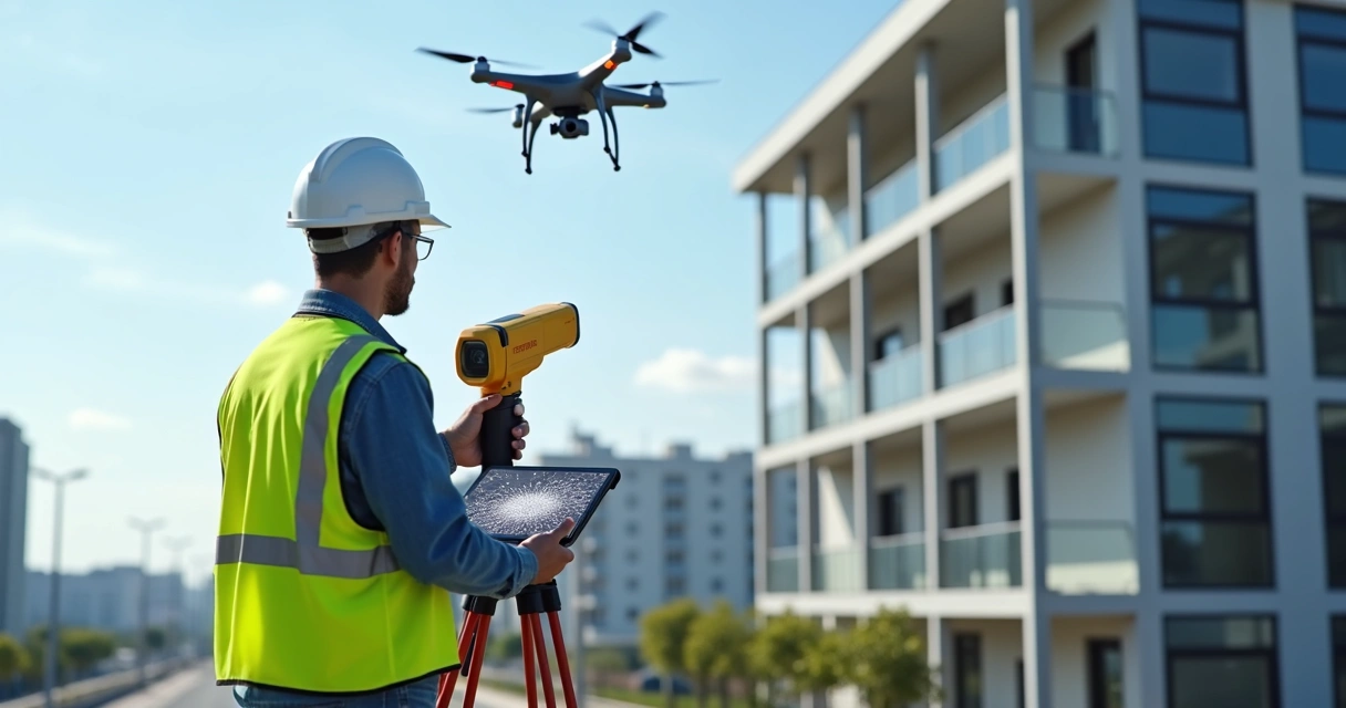
And of course, if your client is one of those obsessed with details, take care and bring electronic equipment, tablets and, who knows, even drones. But... always test your gadgets first and check the battery. Don't underestimate the power of well-used paper and pencils!
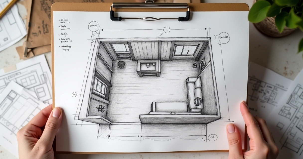
“Measuring is easy, measuring right is another story.” The secret lies in the details. Start by demarcating the perimeter, the main piece to avoid drawing a cube when the property is, in fact, an irregular polygon.
All of this organized in simple sketches, filled with indications and arrows. Here, precision is worth more than the beauty of the line.
Forget that phrase that a picture is worth a thousand words. In the world of Render architecture, photo without a caption doesn't save anyone. Capture every corner, coating details, visible installations, and points that deserve attention.
Golden tip: attach labels and digital arrows to images as soon as possible so you don't get lost later. Some professionals swear that they will remember what that “patch in the footer” was, but months later... no one escapes oblivion.
Of course, today's professional doesn't live on pencils and braid alone. The use of portable 3D scanners has grown, allowing architectural measurement to be digitized in real time, with an accuracy of up to millimeters. Digital models generated in this way can be imported into BIM software, saving hours of rework.
Drones are also allies, especially in large buildings or outdoor areas. Mobile apps, on the other hand, multiply the power of the smartphone to create instant plans from photos and even LiDAR sensing.
Still, for most residential projects, the good double braid + paper remains unbeatable in value for money.
Now begins the part that really shows the client the value of your work. It's no use a bunch of numbers and sketches if the result doesn't enchant those who pay the bill.
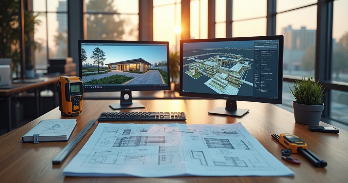
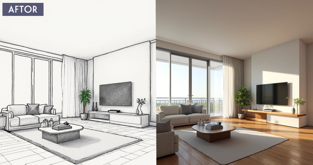
After the architectural registration, you model the property using your favorite software: SketchUp, Revit, Promob, AutoCAD... From there, it generates the views, cuts, floor plans, and 3D models. Want to take that next step? Render a realistic scene. And for this, Redraw is a practical solution, since it does not require complex configurations. Just prepare the scene in the software, capture the image or screenshot and process it in Redraw. The result: surprising images, ready to present, sell ideas and win approvals.
Your measurement, your art — but your rendering must impress!
This combination of technical survey precision and impactful visualization is what separates an ordinary project from a memorable experience for those who hire.
The controversial question comes in: how much to charge? It depends. But, in order not to evade responsibility, see the values practiced:
Of course, risks, travel, time spent, and degree of difficulty are included. And don't forget: if the team uses technology (3D scanners, drones, tablets), the cost will accrue according to equipment and expertise.
Oh, and don't get caught up in the budget tale without a technical visit. Only those who set foot on the spot know how long each measurement will take.
To avoid these missteps, check everything again before finalizing the documentation. And if something doesn't work, go back there. It's a waste of time just until the headache comes later.
Not every measurement is the same, although the name sounds like it. See the difference:
Conclusion? Each one has a function and is not a substitute for the other. In complete projects, they are usually complementary.
It is the process of measuring and documenting an existing building in detail, recording room dimensions, door and window positions, wall thicknesses, electrical and hydraulic installations, and other construction elements. It serves as a starting point for renovations, adjustments, or even for researching the property's past.
The secret lies in measuring everything carefully, recording it in hand sketches, photographing each environment with notes, checking the diagonals and verifying that each record makes sense. Use trena (preferably laser for large areas), basic tools, and don't rely solely on existing plants. Make revisions after completing each step on site.
Steel tape, laser tape, sketchpad, pencil, eraser, level, square, smartphone for photos and, for the most modern, 3D scanner, drone and digital measurement applications. The common sense to decide between paper and technology also never goes out of style.
It serves for a detailed record of the real conditions of a building, facilitating renovations, adaptation of projects, regulation with public agencies, approval of condominiums, and even sale or rental of properties. It also provides security to predict costs and plan schedules.
In 2025, the average cost varies between R$ 5 and R$ 15 per square meter, depending on the type of property, complexity of the service, equipment used and the need for detailing. Lower values tend to involve only large areas or fewer details, while older, detailed properties require a larger budget.
Coming to an end, the lesson is simple: there is no good project without a well done architectural survey. If you want more than complete the table, make a detailed registration and transform your measurements into impactful images. Have you seen how Redraw can catalyze this process? Just capture the scene in your software, send it to the platform and let the artificial intelligence work.
The difference is in the presentation: transform data into renders that win customers!
If you are looking to value your technical work and want to see your projects truly come to life, discover the exclusive resources of Redraw and submit your images to test. Your next performance may be unforgettable.
Blog

The AI that transforms how you create architecture, engineering and design projects.
Redraw ai solutions LLC